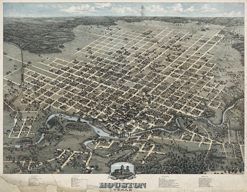
Exactly 36 years after a pair of New York land speculators incorporated a muddy, mosquito-infested Texas outpost on June 5, 1837, the city of Houston looked radically different. This stunning 1873 bird’s-eye map captures the dramatic evolution of the frontier settlement, showing how a grid of iron railroads and rising industry completely conquered the untamed southern bayou.
When the Allen brothers first advertised the townsite in 1837, they promised a grand, bustling metropolis to potential buyers. In reality, it was a primitive camp of tents and log cabins plagued by devastating outbreaks of yellow fever. By the time this panoramic map was drawn in the 1873 post-Civil War reconstruction era, Houston had successfully transformed its geography to become a booming, organized hub for the global cotton and timber trade.